04
SeptemberWhat Are Planning Photomontages and Why Do Councils Require Them
A proposed development can look very different on a technical drawing compared with how it may appear in the real environment. Plans, elevations and architectural drawings explain dimensions, materials and design intent, but they do not always make the visual outcome easy to understand. This is where a planning photomontage can provide valuable context. By placing a digital representation of a proposed development into a photograph of the existing site, it gives councils, planners, consultants and communities a clearer idea of how the proposal may appear from a particular viewpoint.
For projects where visual appearance is an important planning consideration, photomontage services in Queensland can form part of the supporting documentation used to communicate potential changes to the surrounding environment.
What Is a Planning Photomontage?
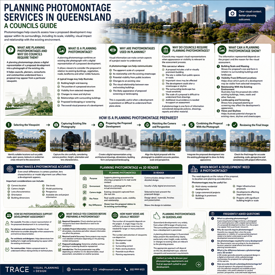
A planning photomontage is a visual representation that combines an existing site photograph with a digital representation of a proposed development. The photograph establishes the real-world setting, while the proposed building or structure is incorporated into the image. This allows viewers to consider the proposal in relation to existing buildings, vegetation, roads, landforms and other visible features.
A typical image may help illustrate:
- Building height and massing
- The position of a proposed structure
- Visibility from selected viewpoints
- Changes to views and skylines
- Relationships with surrounding buildings
- Proposed landscaping or screening
- The overall visual presence of a development
Why Are Photomontages Used in Planning?
Development assessment often requires consideration of how a proposal will interact with its surroundings. While written reports and technical drawings remain important, visual information can make certain aspects of a project easier to understand.
A photomontage can help communicate:
- The apparent scale of a proposal
- Its relationship with the existing streetscape
- Potential visibility from public locations
- Changes to an existing view
- The visual relationship between new and existing buildings
- The likely appearance of proposed screening or landscaping
This can be particularly useful when a development is prominent or when its visual effects are difficult to understand from plans alone.
Why Do Councils Require Planning Photomontages?
Councils may request visual representations when the appearance or visibility of a development is relevant to the assessment process.
This can occur where:
- A proposal includes a tall or visually prominent building
- The site is visible from public spaces or roads
- Important views may be affected
- The development could alter a streetscape or skyline
- The surrounding landscape has visual sensitivity
- The scale of a proposal is difficult to understand from drawings
- Additional visual evidence is needed to support an assessment
A photomontage does not, by itself, determine whether a project should be approved. It is one form of information that can be considered alongside planning policies, architectural documentation, reports and other assessment material.
What Can a Planning Photomontage Show?
The information represented will depend on the project and the reason the visual assessment is being undertaken.
- Building Scale and Massing: Shows the proposal’s size and form in relation to surrounding buildings and landscape.
- Visibility From Different Locations: Helps show which parts of a development may be visible from selected viewpoints.
- Relationship With the Existing Environment: Illustrates how the proposal sits within existing buildings, trees, roads and other features.
- Landscaping and Screening: Shows how proposed planting or screening may affect the development’s appearance.
- Views and Skylines: Helps illustrate potential changes to existing views, skylines and streetscapes.
How Is a Planning Photomontage Prepared?
Creating a reliable visual representation involves more than placing a building over a photograph. Several elements need to work together so that the proposed development appears consistently within the selected setting.
1. Selecting the Viewpoint
Identify suitable locations such as public roads, open spaces, lookouts or pedestrian areas relevant to the assessment.
2. Capturing Existing Site Photography
Capture the site carefully, considering camera position, height, orientation and lens characteristics.
3. Preparing the Proposed Development
Create a digital representation using architectural drawings, dimensions, building form and proposed landscaping.
4. Matching the Camera and Perspective
Align the digital proposal with the photograph to establish accurate position, scale and perspective.
5. Combining the Proposal With the Photograph
Integrate the proposed development into the existing photograph to show its likely appearance.
6. Reviewing the Final Image
Check the final image for accurate positioning, scale, perspective and consistency with project information.
What Makes a Photomontage Accurate?
Accuracy matters because even small differences in camera position, lens characteristics or model alignment can affect how a development appears. TRACE Visual Planning + Design focuses on carefully prepared visual representations that reflect the proposed development accurately.
Important considerations can include:
- Camera location
- Camera height
- Lens characteristics
- Orientation
- Building dimensions
- Site levels
- Model positioning
- Perspective
- Available site and project information
Planning Photomontage vs 3D Render
A planning photomontage and a 3D render can look similar, but they generally have different purposes. A 3D render is usually created to communicate design intent. It may use a fully digital environment and a camera angle selected to present the proposed design. A planning photomontage begins with a photograph of the actual environment and incorporates the proposed development into that setting. The key distinction is real-world context. The latter helps viewers consider how a proposal may relate to its existing surroundings rather than viewing the design in isolation.
When Might a Development Need a Photomontage?
Not every development requires one. The need for visual documentation depends on the nature of the proposal, its location and the relevant planning considerations.
Photomontages may be useful for:
- Multi-storey residential developments
- Large commercial projects
- Buildings in prominent locations
- Major infrastructure proposals
- Developments affecting important views
- Projects with significant building height or scale
How Many Views Are Usually Needed?
There is no universal number of viewpoints for every project. A single image may be sufficient for a straightforward visual question, while a larger or more prominent proposal may need several views to demonstrate how it appears from different locations.
The number and selection of viewpoints can depend on:
- Development scale
- Site visibility
- Surrounding context
- Public viewing locations
- Potential visual effects
- Planning requirements
How Do Photomontages Support Development Assessment?
Visual material can make a complex proposal easier to communicate, and a planning photomontage in Queensland can help councils, planners, consultants and communities understand the proposed development more clearly.
For councils, it can provide a clearer representation of the proposed development in its surroundings.
For planners and consultants, it can provide visual information to consider alongside written assessments and technical documentation.
For architects and designers, it can help demonstrate how building form, height and landscaping may appear within the existing environment.
For communities, it can make a proposal easier to understand without relying entirely on technical plans.
In this way, a planning photomontage can act as both a visual assessment resource and a communication tool.
What Should You Consider Before Preparing a Photomontage?
Before starting a project, it is useful to establish what the planning process requires and what the final images need to demonstrate.
Consider the following:
Required Viewpoints
Check whether particular viewpoints have already been identified or whether suitable locations need to be established.
Available Project Information
Architectural drawings, dimensions, site photographs and other relevant information can affect the preparation process.
Required Level of Accuracy
Some projects may require more detailed verification depending on their planning context and the purpose of the visual material.
Proposed Landscaping
If planting or screening is an important part of the proposal, determine whether and how it should be represented.
Intended Use
The final presentation may differ depending on whether the images are being prepared for development documentation, visual assessment, consultation or another planning purpose.
Planning Photomontages in Queensland
Queensland developments can range from urban infill and residential projects to larger commercial and infrastructure proposals. In each case, the surrounding environment can influence how a development is perceived. A planning photomontage in Queensland can help present this relationship in a straightforward visual format, particularly when height, scale, visibility or changes to existing views are relevant to the planning process. The appropriate approach will depend on the site, development type, selected viewpoints and assessment requirements.
Conclusion
Planning photomontages help show how a proposed development may appear within its existing surroundings, including its scale, visibility, form and landscaping. Councils may request them where a project could create noticeable visual changes. Trace Visual Planning + Design provides clear, carefully prepared visual documentation tailored to project requirements. Contact us today to discuss your photomontage requirements and find an approach suited to your development.