28
JuneHow Councils Use Landscape Character Assessment (LCA) Studies in Planning Decisions
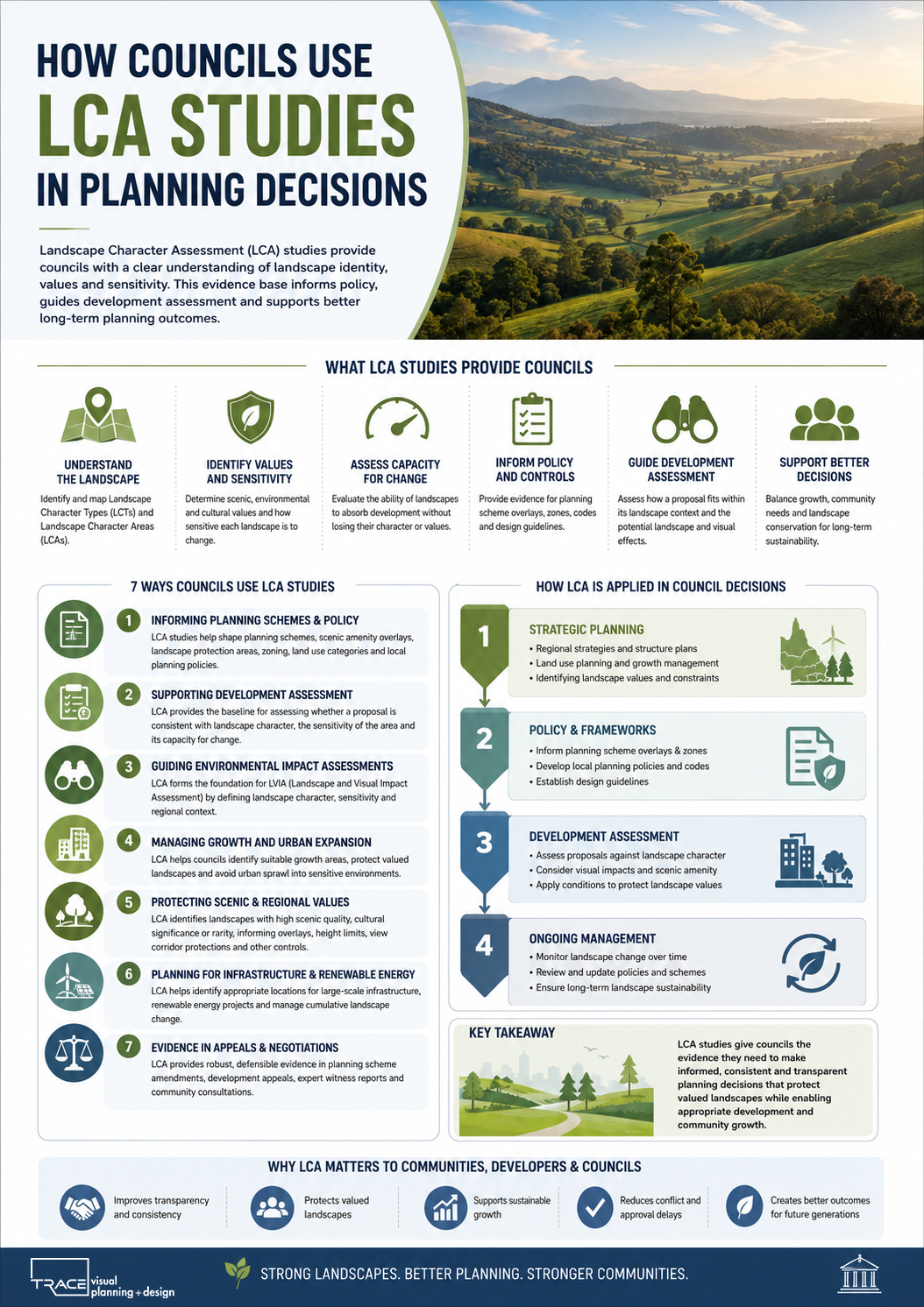
Landscape Character Assessment (LCA) studies play an important role in how local governments assess development proposals and shape long-term planning policy. In Australia—particularly in Queensland—councils use LCA as a strategic evidence base to understand landscape values, guide growth, and manage change in sensitive environments.
Rather than being a standalone approval tool, LCA informs multiple layers of planning decision-making, from strategic land use planning to development assessment.
What is the Role of LCA in Council Planning?
At its core, LCA helps councils answer a key planning question:
“What type of landscape do we have, how valuable is it, and how much change can it reasonably absorb?”
Councils use LCA to:
- Identify and map landscape character areas
- Understand scenic and visual values at a regional scale
- Inform planning schemes and zoning decisions
- Guide development assessment conditions
- Support Environmental Impact Statements (EIS)
- Protect high-value or sensitive landscapes
LCA is therefore a strategic planning tool, not just a project-level assessment.
1. Informing Planning Schemes and Policy
One of the most important uses of LCA is in the preparation or review of local planning schemes.
Councils use LCA outputs to:
- Define scenic amenity overlays
- Identify landscape protection areas
- Shape urban growth boundaries
- Establish design and siting policies
- Guide rural and peri-urban development controls
For example, a council may use LCA findings to restrict high-density development in a visually prominent coastal escarpment area, or to encourage more intensive use in already modified agricultural landscapes.
2. Supporting Development Assessment Decisions
During development assessment, LCA provides a baseline understanding of:
- Landscape sensitivity
- Character significance
- Capacity for change
- Visual and contextual context of a site
This helps planners assess whether a proposal is:
- Consistent with landscape character
- Likely to cause unacceptable visual intrusion
- Appropriately sited within its context
In this way, LCA informs conditions such as:
- Building height limits
- Setbacks from ridgelines or coastlines
- Vegetation retention requirements
- Material and colour controls
3. Guiding Environmental Impact Assessment (EIA) and LVIA
For major projects (wind farms, solar farms, infrastructure), councils often require LCA as a baseline input into LVIA (Landscape and Visual Impact Assessment).
LCA helps define:
- Landscape Character Types (LCTs)
- Sensitivity of different landscape units
- Areas of high scenic value
- Regional landscape structure
This ensures that visual assessments are grounded in a consistent understanding of landscape context rather than isolated viewpoints.
4. Managing Growth and Urban Expansion
Councils use LCA at the strategic level to guide where growth should and should not occur.
This includes decisions about:
- Urban expansion corridors
- New residential growth areas
- Industrial and infrastructure zones
- Rural residential development pressure
LCA helps planners avoid fragmenting high-value landscapes or creating visually incoherent development patterns.
5. Protecting Scenic and Regional Landscape Values
LCA is often used to identify landscapes that have:
- High scenic quality
- Strong cultural or heritage associations
- Rare or distinctive landscape features
- High community value
These areas may be subject to:
- Scenic protection overlays
- Development height restrictions
- View corridor protection policies
- Special assessment requirements
This is particularly relevant in coastal, hinterland, and mountainous regions.
6. Supporting Renewable Energy and Infrastructure Planning
In Queensland and other Australian states, councils increasingly use LCA to manage renewable energy development.
For example, LCA helps identify:
- Appropriate locations for solar farms
- Visually constrained areas for wind energy
- Cumulative landscape change risk zones
This supports a more proactive approach to infrastructure planning, rather than reactive assessment at the development stage.
7. Providing Evidence in Planning Appeals and Negotiations
LCA studies are also used as technical evidence in:
- Planning appeals (e.g. development refusals or conditions)
- Expert planning evidence in tribunals
- Negotiations between developers and councils
- Community consultation processes
Because LCA is structured and evidence-based, it provides a defensible framework for decision-making.
How Councils Typically Apply LCA in Practice
In real-world planning workflows, councils use LCA in three key ways:
1. Strategic Layer
- Planning schemes
- Regional planning strategies
- Growth management frameworks
2. Assessment Layer
- Development applications
- Code and impact assessments
- Referral advice
3. Evidence Layer
- Expert reports (LVIA, VIA)
- Environmental impact statements
- Appeals and reviews
Key Limitations of LCA in Council Decision-Making
While powerful, LCA is not absolute. Councils must also consider:
- Economic and infrastructure needs
- Housing demand and urban growth pressures
- State or regional planning directives
- Engineering feasibility constraints
- Community consultation outcomes
LCA informs decisions, but does not determine them alone.
Why LCA Matters for Better Planning Outcomes
When used effectively, LCA helps councils:
- Make more transparent and consistent planning decisions
- Protect valued landscapes while enabling appropriate development
- Reduce conflict between developers and communities
- Improve the quality of built form outcomes
- Integrate environmental and visual considerations early in planning
Conclusion
Landscape Character Assessment is a foundational planning tool used by councils to understand, manage, and guide change in the landscape. It informs strategic planning, supports development assessment, and strengthens environmental impact processes by providing a clear understanding of landscape identity and sensitivity.
In practice, LCA helps ensure that growth and development occur in a way that respects the underlying structure and character of the landscape, while still allowing for necessary change and infrastructure delivery.