28
JuneFuture of visual impact assessment in Australia (2026 update)
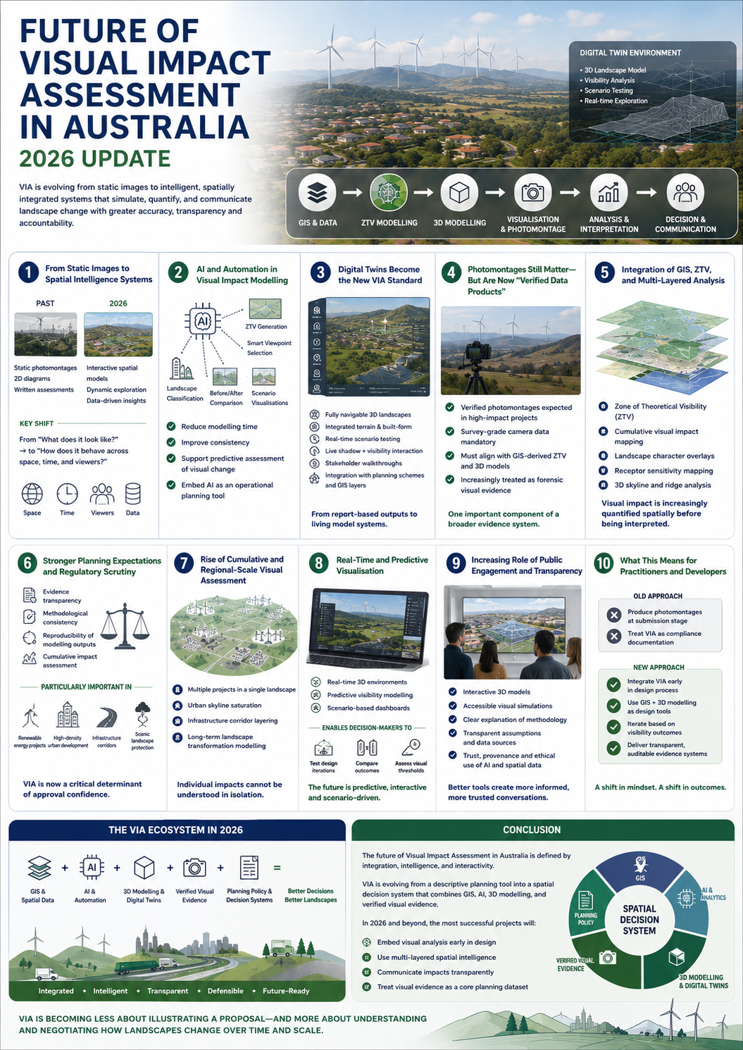
Visual Impact Assessment (VIA) in Australia is undergoing a rapid transformation. What was once a largely static, photomontage-based discipline is evolving into a data-driven, AI-enabled, and spatially integrated system of environmental evidence.
In 2026, VIA is no longer just about illustrating change—it is about simulating, quantifying, and communicating landscape transformation with higher spatial intelligence and accountability.
This shift is being driven by advances in GIS, digital twins, remote sensing, AI modelling, and planning system expectations around transparency and evidence quality.
1. From Static Images to Spatial Intelligence Systems
Traditionally, VIA relied heavily on:
- Photomontages
- 2D visibility diagrams
- Written landscape assessments
In 2026, these are being replaced or supplemented by interactive spatial models that allow planners to explore impacts dynamically.
Key shift:
- From “What does it look like?”
→ to “How does it behave across space, time, and viewers?”
This aligns with broader geospatial trends where GIS is becoming a decision intelligence platform rather than a mapping tool.
2. AI and Automation in Visual Impact Modelling
Artificial intelligence is beginning to reshape how VIA is produced.
Emerging capabilities include:
- Automated visibility detection (ZTV generation)
- AI-assisted viewpoint selection based on receptor sensitivity
- Machine learning–based landscape classification
- Automated comparison of before/after visual change
- Rapid generation of multiple scenario visualisations
AI is also being used to:
- Reduce modelling time
- Improve consistency across outputs
- Support predictive assessment of visual change
This reflects a broader 2026 trend of AI becoming embedded in geospatial and planning systems as an operational layer, not just an analytical tool.
3. Digital Twins Become the New VIA Standard
One of the most significant shifts is the rise of 3D digital twin environments.
Instead of producing isolated outputs, practitioners are building:
- Fully navigable 3D landscapes
- Integrated built-form and terrain models
- Real-time scenario testing environments
What this enables:
- Live testing of development options
- Dynamic shadow + visibility interaction
- Stakeholder walkthroughs of proposed change
- Integration with planning schemes and GIS layers
This moves VIA from a report-based process to a living model system.
4. Photomontages Still Matter—but Are Now “Verified Data Products”
Photomontages are not disappearing. Instead, they are becoming more rigorous and standardised.
In 2026:
- Verified photomontages are expected in high-impact projects
- Survey-grade camera data is mandatory in many assessments
- Outputs must align with GIS-derived ZTV and 3D models
- Courts increasingly treat them as forensic visual evidence
However, they are now just one component of a broader system rather than the primary tool.
5. Integration of GIS, ZTV, and Multi-Layered Analysis
Modern VIA workflows are deeply integrated with GIS-based systems.
Common components now include:
- Zone of Theoretical Visibility (ZTV) modelling
- Cumulative visual impact mapping
- Landscape character overlays
- Receptor sensitivity mapping
- 3D skyline and ridge analysis
As noted in current industry practice, GIS is now central to spatial analysis and visibility modelling in LVIA workflows.
Result:
Visual impact is no longer subjective alone—it is increasingly quantified spatially before interpretation.
6. Stronger Planning Expectations and Regulatory Scrutiny
Australian planning systems are placing greater emphasis on:
- Evidence transparency
- Methodological consistency
- Reproducibility of modelling outputs
- Cumulative impact assessment
This is particularly visible in:
- Renewable energy projects (wind and solar farms)
- High-density urban development
- Infrastructure corridors
- Scenic landscape protection areas
In contested developments, VIA is now a critical determinant of approval confidence, not just a supporting report.
7. Rise of Cumulative and Regional-Scale Visual Assessment
A major evolution is the shift from site-based assessment to regional visual systems thinking.
New focus areas:
- Multiple wind or solar projects in a single landscape
- Urban skyline saturation
- Infrastructure corridor layering
- Long-term landscape transformation modelling
This reflects growing recognition that individual project impacts cannot be understood in isolation.
8. Real-Time and Predictive Visualisation
By 2026, some planning systems are beginning to adopt:
- Real-time 3D rendering environments
- Predictive visibility modelling
- Scenario-based decision dashboards
This enables planners and stakeholders to:
- Test design iterations instantly
- Compare multiple development outcomes
- Assess visual thresholds interactively
The direction of travel is toward predictive visual planning systems, not static reporting.
9. Increasing Role of Public Engagement and Transparency
As visual tools become more advanced, expectations for public engagement are also increasing.
Communities now expect:
- Interactive 3D models (not just PDFs)
- Accessible visual simulations
- Clear explanation of methodology
- Transparent assumptions behind visual outputs
At the same time, governments are emphasising trust, provenance, and ethical use of AI and spatial data.
10. What This Means for Practitioners and Developers
The future of VIA in Australia requires a shift in mindset.
Old approach:
- Produce photomontages at submission stage
- Treat VIA as compliance documentation
New approach:
- Integrate VIA early in design process
- Use GIS + 3D modelling as design tools
- Iterate based on visibility outcomes
- Deliver transparent, auditable evidence systems
Conclusion
The future of Visual Impact Assessment in Australia is defined by integration, intelligence, and interactivity.
VIA is evolving from a descriptive planning tool into a spatial decision system that combines GIS, AI, 3D modelling, and verified visual evidence.
In 2026 and beyond, the most successful projects will be those that:
- Embed visual analysis early in design
- Use multi-layered spatial intelligence
- Communicate impacts transparently
- Treat visual evidence as a core planning dataset
Ultimately, VIA is becoming less about illustrating a proposal—and more about understanding and negotiating how landscapes change over time and scale.