28
JuneTop 10 Visual Planning Mistakes Developers Make
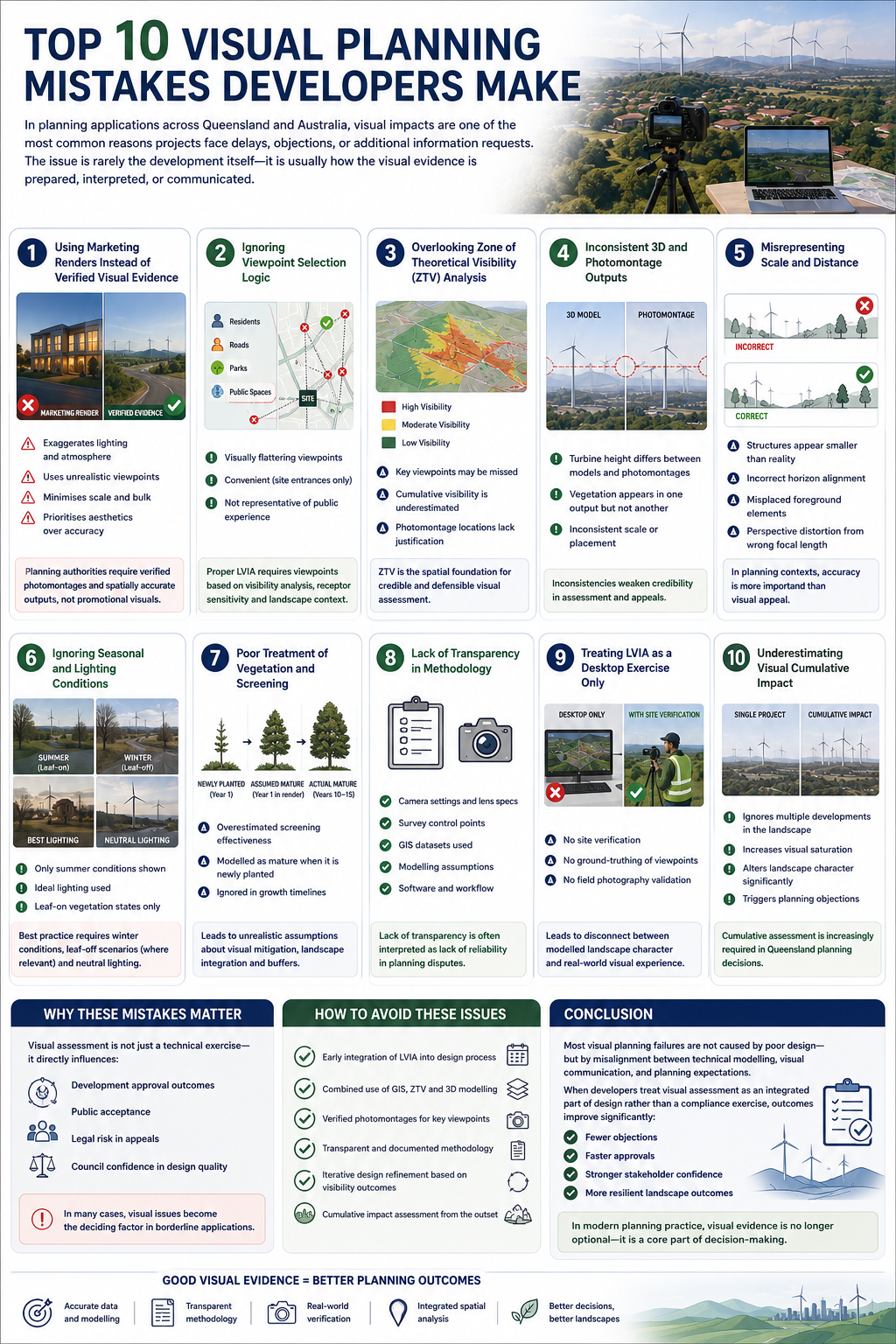
In planning applications across Queensland and Australia, visual impacts are one of the most common reasons projects face delays, objections, or additional information requests. The issue is rarely the development itself—it is usually how the visual evidence is prepared, interpreted, or communicated.
Below are the top 10 visual planning mistakes developers make, particularly in relation to Landscape and Visual Impact Assessment (LVIA), photomontages, GIS modelling, and design communication.
1. Using Marketing Renders Instead of Verified Visual Evidence
One of the most frequent mistakes is submitting architectural renders as visual impact evidence.
Marketing renders often:
- Exaggerate lighting and atmosphere
- Use unrealistic viewpoints
- Minimise scale and bulk
- Prioritise aesthetics over accuracy
Planning authorities require verified photomontages and spatially accurate outputs, not promotional visuals.
2. Ignoring Viewpoint Selection Logic
Developers often choose viewpoints that are:
- Visually flattering
- Convenient (site entrances only)
- Not representative of public experience
However, proper LVIA requires viewpoints based on:
- Visibility analysis (ZTV/ZVI)
- Receptor sensitivity (residents, roads, parks)
- Landscape character context
Poor viewpoint selection can undermine the entire assessment.
3. Overlooking Zone of Theoretical Visibility (ZTV) Analysis
Skipping or underestimating ZTV modelling is a major technical gap.
Without ZTV:
- Key viewpoints may be missed
- Cumulative visibility is underestimated
- Photomontage locations lack justification
ZTV is the spatial foundation for credible visual assessment.
4. Inconsistent 3D and Photomontage Outputs
A common error is inconsistency between:
- 3D massing models
- Photomontage renderings
- LVIA narrative descriptions
For example:
- A turbine height differs between GIS model and photomontage
- Vegetation screening appears in one output but not another
This inconsistency weakens credibility in assessment and appeals.
5. Misrepresenting Scale and Distance
Even small errors in scale can significantly distort perception.
Typical issues include:
- Structures appearing smaller than reality
- Incorrect horizon alignment
- Misplaced foreground elements
- Perspective distortion from wrong focal length
In planning contexts, accuracy is more important than visual appeal.
6. Ignoring Seasonal and Lighting Conditions
Visual impacts vary significantly across seasons, yet many assessments only show:
- Summer conditions
- Ideal lighting
- Leaf-on vegetation states
Best practice requires:
- Winter conditions (worst-case shadow and visibility)
- Leaf-off scenarios where relevant
- Neutral lighting conditions
7. Poor Treatment of Vegetation and Screening
Vegetation is often:
- Overestimated in screening effectiveness
- Modelled as mature when it is newly planted
- Ignored in growth timelines
This leads to unrealistic assumptions about:
- Long-term visual mitigation
- Landscape integration
- Buffer effectiveness
8. Lack of Transparency in Methodology
Many visual reports fail because they do not clearly document:
- Camera settings and lens specifications
- Survey control points
- GIS datasets used
- Modelling assumptions
In planning disputes, lack of transparency is often interpreted as lack of reliability.
9. Treating LVIA as a Desktop Exercise Only
Some developers rely solely on remote modelling without:
- Site verification
- Ground-truthing viewpoints
- Field photography validation
This leads to disconnect between:
- Modelled landscape character
- Real-world visual experience
On-site verification remains essential.
10. Underestimating Visual Cumulative Impact
A major and often decisive mistake is ignoring cumulative visual change, especially in:
- Renewable energy zones
- Peri-urban expansion areas
- Infrastructure corridors
Even if a single project is acceptable, combined impacts may:
- Alter landscape character significantly
- Increase visual saturation
- Trigger planning objections
Cumulative assessment is increasingly required in Queensland planning decisions.
Why These Mistakes Matter
Visual assessment is not just a technical exercise—it directly influences:
- Development approval outcomes
- Public acceptance
- Legal risk in appeals
- Council confidence in design quality
In many cases, visual issues become the deciding factor in borderline applications.
How to Avoid These Issues
Best practice typically includes:
- Early integration of LVIA into design process
- Combined use of GIS, ZTV, and 3D modelling
- Verified photomontages for key viewpoints
- Transparent and documented methodology
- Iterative design refinement based on visibility outcomes
- Cumulative impact assessment from the outset
Conclusion
Most visual planning failures are not caused by poor design—but by misalignment between technical modelling, visual communication, and planning expectations.
When developers treat visual assessment as an integrated part of design rather than a compliance exercise, outcomes improve significantly:
- Fewer objections
- Faster approvals
- Stronger stakeholder confidence
- More resilient landscape outcomes
In modern planning practice, visual evidence is no longer optional—it is a core part of decision-making.