28
JuneHow photomontage simulations are used in planning courts
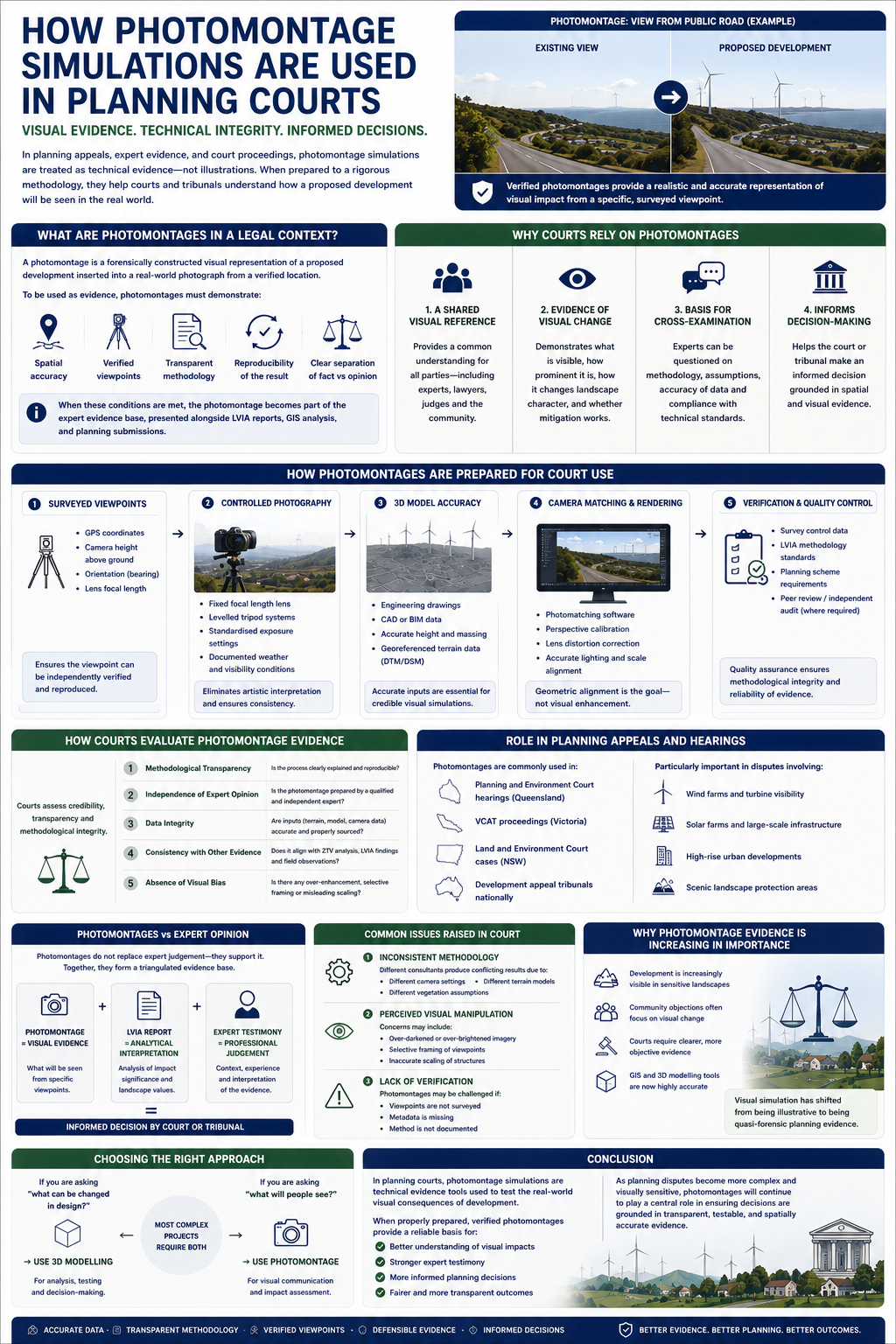
Photomontage simulations play a critical role in planning appeals, expert evidence, and court proceedings where visual impact is a contested issue. In these settings, they are not treated as illustrations or design graphics—they are treated as technical evidence used to test the visual effects of proposed development.
In Australia (including Queensland), courts and planning tribunals increasingly rely on verified photomontages as part of Landscape and Visual Impact Assessment (LVIA) evidence to understand how a development will be seen in reality.
What Are Photomontages in a Legal Context?
In planning courts, a photomontage is a forensically constructed visual representation of a proposed development inserted into a real-world photograph.
However, unlike marketing visuals, court-admissible photomontages must demonstrate:
- Spatial accuracy (correct location and scale)
- Verified viewpoints (surveyed camera positions)
- Transparent methodology
- Reproducibility of the result
- Clear separation between fact and interpretation
When these conditions are met, the photomontage becomes part of the expert evidence base, typically presented alongside LVIA reports, GIS analysis, and planning submissions.
Why Courts Rely on Photomontages
Planning courts and tribunals deal with disputes where visual impact is subjective and difficult to describe in words alone. Photomontages help resolve this by providing:
1. A Shared Visual Reference
They allow all parties—experts, lawyers, judges, and community representatives—to see the same predicted outcome from the same viewpoint.
2. Evidence of Visual Change
They demonstrate:
- What is visible
- How prominent it is
- How it changes landscape character
- Whether mitigation measures are effective
3. A Basis for Cross-Examination
Experts can be questioned on:
- Methodology used
- Assumptions in modelling
- Accuracy of terrain and vegetation data
- Compliance with technical standards
How Photomontages Are Prepared for Court Use
For court or tribunal proceedings, photomontages must follow a rigorous and defensible workflow.
1. Surveyed Viewpoints
Each viewpoint is precisely documented:
- GPS coordinates
- Camera height above ground
- Orientation (bearing)
- Lens focal length
This ensures the viewpoint can be independently verified.
2. Controlled Photography
Images are captured using:
- Fixed focal length lenses (no zoom distortion)
- Levelled tripod systems
- Standardised exposure settings
- Documented weather and visibility conditions
This eliminates artistic interpretation.
3. 3D Model Accuracy
The proposed development is modelled using:
- Engineering drawings
- CAD or BIM data
- Accurate height and massing information
- Georeferenced terrain data (DTM/DSM)
4. Camera Matching and Rendering
The 3D model is inserted into the photograph using:
- Photomatching software
- Perspective calibration
- Lens distortion correction
The goal is geometric alignment, not visual enhancement.
5. Verification and Quality Control
Before submission, the output is checked against:
- Survey control data
- LVIA methodology standards
- Planning scheme requirements
- Peer review or independent audit (in some cases)
How Courts Evaluate Photomontage Evidence
Courts do not automatically accept photomontages at face value. Instead, they assess their credibility, transparency, and methodological integrity.
Key evaluation criteria include:
1. Methodological Transparency
Is the process clearly explained and reproducible?
2. Independence of Expert Opinion
Is the photomontage prepared by a qualified and independent expert?
3. Data Integrity
Are inputs (terrain, model, camera data) accurate and properly sourced?
4. Consistency with Other Evidence
Does it align with:
- ZTV (Zone of Theoretical Visibility) analysis
- LVIA findings
- Field observations
5. Absence of Visual Bias
Courts are cautious of:
- Over-enhanced rendering
- Selective framing
- Misleading scaling or atmospheric effects
Role in Planning Appeals and Hearings
Photomontages are commonly used in:
- Planning and Environment Court hearings (Queensland)
- VCAT proceedings (Victoria)
- Land and Environment Court cases (NSW)
- Development appeal tribunals nationally
They are particularly important in disputes involving:
- Wind farms and turbine visibility
- Solar farms and large-scale infrastructure
- High-rise urban developments
- Scenic landscape protection areas
Photomontages vs Expert Opinion
A key legal principle is that photomontages do not replace expert judgement—they support it.
Courts consider:
- Photomontage = visual evidence
- LVIA report = analytical interpretation
- Expert testimony = professional judgement
Together, they form a triangulated evidence base for decision-making.
Common Issues Raised in Court
Disputes often arise when:
1. Inconsistent Methodology
Different consultants produce conflicting visualisations due to:
- Different camera settings
- Different terrain models
- Different vegetation assumptions
2. Perceived Visual Manipulation
Concerns may include:
- Over-darkened or over-brightened imagery
- Selective framing of viewpoints
- Inaccurate scaling of structures
3. Lack of Verification
Photomontages may be challenged if:
- Viewpoints are not surveyed
- Metadata is missing
- Method is not documented
Why Photomontage Evidence Is Increasing in Importance
The use of photomontage evidence is growing because:
- Development is increasingly visible in sensitive landscapes
- Community objections often focus on visual change
- Courts require clearer, more objective evidence
- GIS and 3D modelling tools are now highly accurate
As a result, visual simulation has shifted from being illustrative to being quasi-forensic planning evidence.
Conclusion
In planning courts, photomontage simulations are not design graphics—they are technical evidence tools used to test the real-world visual consequences of development.
When properly prepared, verified photomontages provide a reliable basis for understanding visual impact, supporting expert testimony, and informing planning decisions in contested environments.
As planning disputes become more complex and visually sensitive, photomontages will continue to play a central role in ensuring decisions are grounded in transparent, testable, and spatially accurate evidence.