28
JuneWhat is a Landscape Character Assessment (LCA)?
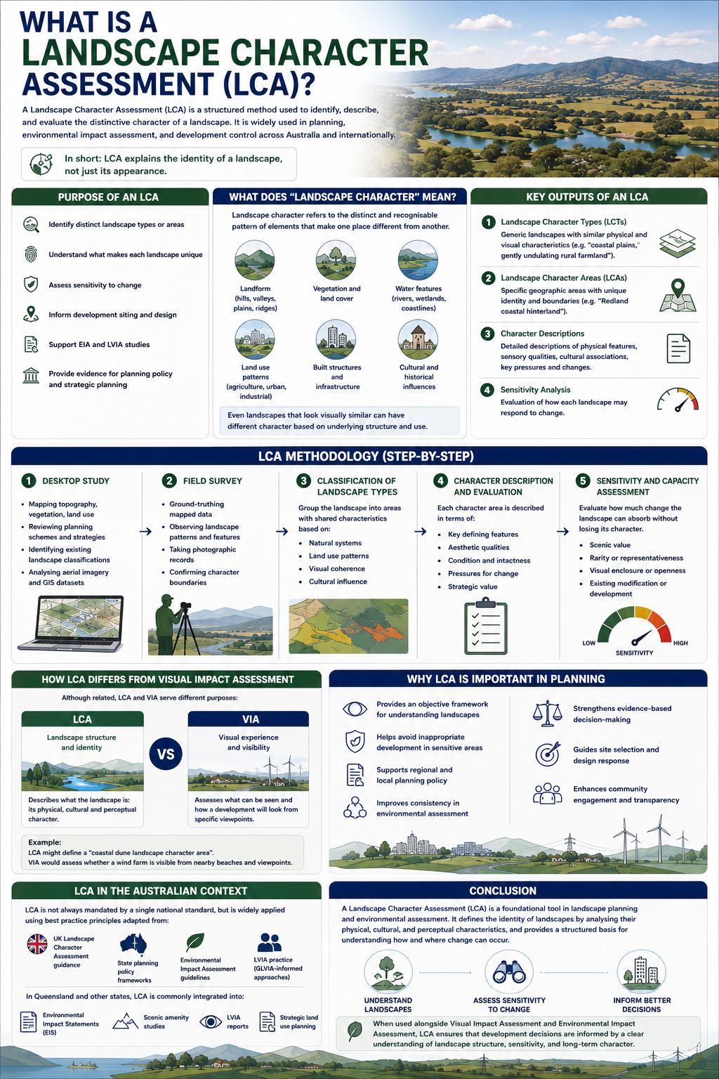
A Landscape Character Assessment (LCA) is a structured method used to identify, describe, and evaluate the distinctive character of a landscape. It is widely used in planning, environmental impact assessment, and development control across Australia and internationally.
Unlike visual impact assessment, which focuses on what people can see, LCA focuses on what the landscape is—its physical structure, natural processes, land use patterns, and cultural influences.
In short:
LCA explains the identity of a landscape, not just its appearance.
Purpose of a Landscape Character Assessment
The main purpose of an LCA is to support better planning decisions by:
- Identifying distinct landscape types or areas
- Understanding what makes each landscape unique
- Assessing sensitivity to change
- Informing development siting and design
- Supporting environmental impact assessments (EIA) and LVIA studies
- Providing evidence for planning policy and strategic planning
In Australia, LCAs are commonly used in EIS documentation, renewable energy projects, urban growth studies, and scenic amenity planning.
What Does “Landscape Character” Mean?
Landscape character refers to the distinct and recognisable pattern of elements that make one place different from another.
These elements include:
- Landform (hills, valleys, plains, ridges)
- Vegetation and land cover
- Water features (rivers, wetlands, coastlines)
- Land use patterns (agriculture, urban, industrial)
- Built structures and infrastructure
- Cultural and historical influences
Even landscapes that look visually similar can have different character based on underlying structure and use.
Key Outputs of an LCA
A Landscape Character Assessment typically produces:
1. Landscape Character Types (LCTs)
Generic landscapes with similar physical and visual characteristics (e.g. “coastal plains,” “gently undulating rural farmland”).
2. Landscape Character Areas (LCAs)
Specific geographic areas with unique identity and boundaries (e.g. “Redland coastal hinterland”).
3. Character Descriptions
Detailed descriptions of:
- Physical features
- Sensory qualities
- Cultural associations
- Key pressures and changes
4. Sensitivity Analysis
An evaluation of how each landscape may respond to change, often considering:
- Landscape value
- Scenic quality
- Intactness and condition
- Capacity to absorb development
LCA Methodology (Step-by-Step)
1. Desktop Study
- Mapping topography, vegetation, land use
- Reviewing planning schemes and regional strategies
- Identifying existing landscape classifications
- Analysing aerial imagery and GIS datasets
2. Field Survey
- Ground-truthing mapped data
- Observing landscape patterns and features
- Taking photographic records
- Confirming character boundaries
3. Classification of Landscape Types
The landscape is grouped into areas with shared characteristics, based on:
- Natural systems
- Land use patterns
- Visual coherence
- Cultural influence
4. Character Description and Evaluation
Each character area is described in terms of:
- Key defining features
- Aesthetic qualities
- Condition and intactness
- Pressures for change
- Strategic value
5. Sensitivity and Capacity Assessment
This step evaluates how much change a landscape can absorb without losing its character.
Factors include:
- Scenic value
- Rarity or representativeness
- Visual enclosure or openness
- Existing modification or development
How LCA Differs from Visual Impact Assessment
Although related, LCA and VIA serve different purposes:
- LCA = Landscape structure and identity
- VIA = Visual experience and visibility
For example:
- LCA might define a “coastal dune landscape character area”
- VIA would assess whether a wind farm is visible from nearby beaches and viewpoints
LCA often forms the baseline framework that informs VIA sensitivity assessments.
Why LCA is Important in Planning
Landscape Character Assessment is essential because it:
- Provides an objective framework for understanding landscapes
- Helps avoid inappropriate development in sensitive areas
- Supports regional and local planning policy
- Improves consistency in environmental assessment
- Strengthens evidence-based decision-making
In renewable energy and infrastructure projects, LCA is often used to guide site selection and design response.
LCA in the Australian Context
In Australia, LCA is not always mandated by a single national standard, but it is widely applied using best practice principles adapted from:
- UK Landscape Character Assessment guidance
- State planning policy frameworks
- Environmental Impact Assessment guidelines
- LVIA practice (GLVIA-informed approaches)
In Queensland and other states, LCA is commonly integrated into:
- Environmental Impact Statements (EIS)
- Scenic amenity studies
- LVIA reports
- Strategic land use planning
Conclusion
A Landscape Character Assessment (LCA) is a foundational tool in landscape planning and environmental assessment. It defines the identity of landscapes by analysing their physical, cultural, and perceptual characteristics, and provides a structured basis for understanding how and where change can occur.
When used alongside Visual Impact Assessment and Environmental Impact Assessment, LCA ensures that development decisions are informed by a clear understanding of landscape structure, sensitivity, and long-term character.